Brussels transport map
You can find on this page the Brussels transport map to print and to download in PDF. The Brussels transportation map presents the transports network and transport zones of the transit of Brussels in Belgium.
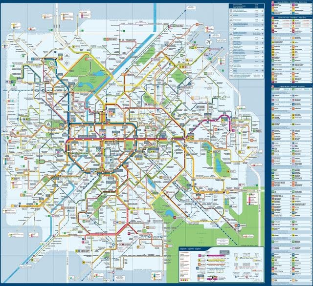
Brussels transports map
The Brussels transport map shows all means of transportation in Brussels. This transports map of Brussels will allow you to move easily with public transport of Brussels in Belgium. The Brussels transportation map is downloadable in PDF, printable and free.
Most public transport in the Brussels-Capital Region is organized by the STIB (Société des Transports intercommunaux bruxellois). The network includes metro lines, which connect the eastern and western districts of the city as its mentioned in Brussels transports map. Pre-metro lines (trams in the tunnels) complete the metro service. A great many metro lines also have above ground bus and tram connections. Timetables: 6 a.m. - midnight - consult the timetables shown at the stops.
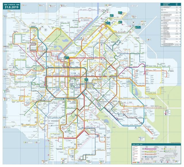
Brussels zone map
The Brussels zone map shows all transport zones in Brussels. This zone map of Brussels will allow you to know the prices of public transport of Brussels in Belgium. The Brussels zones of transports map is downloadable in PDF, printable and free.
The MTB zone includes different stops of other operators, each operator determines his own borders for the MTB zone as its mentioned in Brussels zone map. On the network map, the borders for De Lijn and TEC are indicated. All the MTB stops of the NMBS/SNCB are indicated with a blue icon. The entire STIB network is included in the MTB-zone. However, you need a specific ticket ‘Go2City’ to get from the airport to Brussels city centre by bus 12.