Brussels tram map
You can find on this page the Brussels tram map to print and to download in PDF. The Brussels trams map presents the network, zones, stations and different lines of the tramway of Brussels in Belgium.
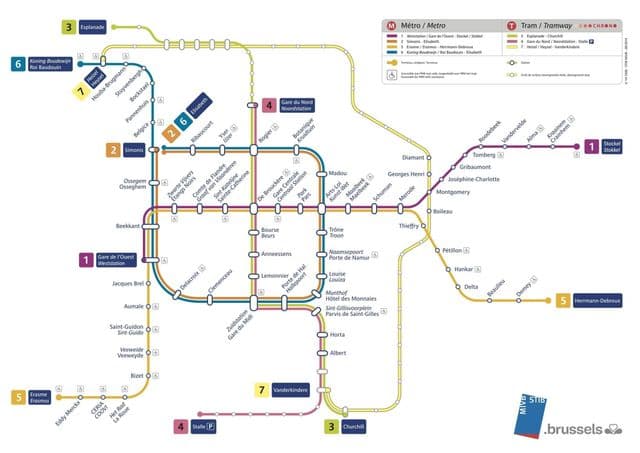
Brussels tramway map
The Brussels tram map shows all the stations and lines of the Brussels tramways. This tramway map of Brussels will allow you to easily plan your routes in the trams of Brussels in Belgium. The Brussels tram map is downloadable in PDF, printable and free.
The Brussels tramway (or streetcar) system is one of the ten largest in the world, carrying some 75.6 million passengers in 2009. Brussels tramway development demonstrates many of the quandaries that face local public transport planners. It also has a number of interesting peculiarities. Brussels tramway line 51: Stops at Brupark as its shown in Brussels tramway map (Atomium and Mini Europe). It is a good alternative to the metro line 6.