Brussels train map
You can find on this page the Brussels trains map to print and to download in PDF. The Brussels trains map presents the rail network and railway stations of the trains of Brussels in Belgium.
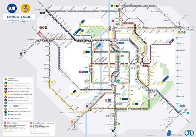
Brussels rail map
The Brussels rails map shows all the railway stations and lines of Brussels trains. This railway map of Brussels will allow you to easily plan your route with the trains of Brussels in Belgium. The Brussels rails map is downloadable in PDF, printable and free.
Brussels is served by direct high-speed rail links as you can see in Brussels rail map: to London by the Eurostar train via the Channel Tunnel (1hr 51 min); to Amsterdam, Paris (1hr 25 min) and Cologne by the Thalys; and to Cologne and Frankfurt by the German ICE. STIB operates three rail modes: tram, pre-metro and full metro, the balance between which has shifted over the years. Brussels rail network has four metro lines and 18 tram lines.