Brussels postcodes map
You can find on this page the Brussels zipcodes map to print and to download in PDF. The Brussels zip code map presents postal codes, address lookup and code list of Brussels in Belgium.
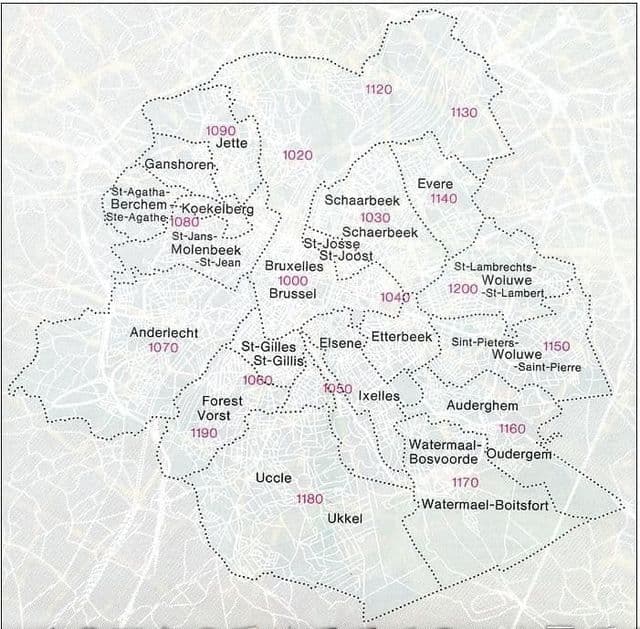
Brussels postcodes map
The Brussels postcodes map shows all the zip codes of Brussels. This zip code map of Brussels will allow you to easily find postal codes and address lookup of Brussels in Belgium. The Brussels postcode map is downloadable in PDF, printable and free.
Brussels is a city in the country of Belgium. Belgium is a country in Europe. There are 3 official language in Belgium: Dutch, German, French. There live about 11.376.070 (1. Januar 2018) people. Brussels has an area of 33075858,54 square meter. If you want to send a parcel or a map to Brussels you need the postcode, which is 1000 as you can see in Brussels postcodes map. The indication to postcode 1000 for Brussels is from May 24, 2019 .