Brussels bus system map
You can find on this page the Brussels buses map to print and to download in PDF. The Brussels bus system map and the Brussels trolley map present the network, stations and lines of the buses and trolley of Brussels in Belgium.
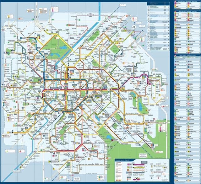
Brussels bus map
The Brussels bus map shows all the stations and lines of the Brussels bus system. This bus map of Brussels will allow you to easily plan your routes in the buses of Brussels in Belgium. The Brussels bus system map is downloadable in PDF, printable and free.
With lines crisscrossing the entire length and breadth of Brussels (and far beyond it) both buses and trams are tried and tested ways of getting around Brussels. You do not need special tickets for taking either, thanks to the unified ticketing system used in Brussels, so just check out the schedules and routes, grab your MOBIB card and enjoy your journey. The STIB buses cover the Brussels metropolitan area as its mentioned in Brussels bus map.